Integrated Research Project 3: where water planning meets urban planning

How can different types of urban development be deliberately guided, at a range of planning scales, to achieve water sensitive outcomes?
This is the big question that we’re tackling with our new Integrated Research Project (IRP3): ‘Guiding integrated urban and water planning’. The CRC for Water Sensitive Cities (CRCWSC) board approved the project scope in early June, so we can now kick off the first of the project’s work packages.
Why IRP3 is important
We know that the way we design our cities, from lot to city scale, affects the water cycle. We also know that incorporating new water technologies into the urban landscape at the start can be very cost effective. Yet very often, we lose these opportunities to create water sensitive urban design because we conduct urban planning and water planning activities in isolation.
IRP3 aims to address this issue, by developing a framework to guide water sensitive urban development. And two recent Ideas for … workshops illustrate the benefits of highly integrated urban and water planning processes. During these workshops—one for Brabham in Western Australia and one for Fishermans Bend in Victoria—the CRCWSC applied its knowledge to create bespoke water sensitive urban design solutions for two very different urban developments.
Brabham, a greenfield urban development in Western Australia, intersects the groundwater table, with groundwater often ponding on the surface. Our Ideas for Brabham workshop harnessed hydrology, groundwater, urban design and water engineering experts to consider options for addressing what can be a major constraint to development in Perth.
Working together, we challenged the prevailing urban planning notion that up to 4 m of fill is needed to separate houses and roads from the groundwater table. Rather than trying to remove or hide drainage water, we proposed a ‘village in a wetland’. New development typologies could work with natural processes, allow space for water in the landscape and use this water to create amenity, urban cooling and even a water supply to irrigate local sports ovals. We developed new typologies that responded to the varying depth to groundwater across the site—conventional residual streets and water sensitive urban design treatments for areas with a greater depth to groundwater; and hard edged water features among higher density development in areas where the ground surface intersects the groundwater table.
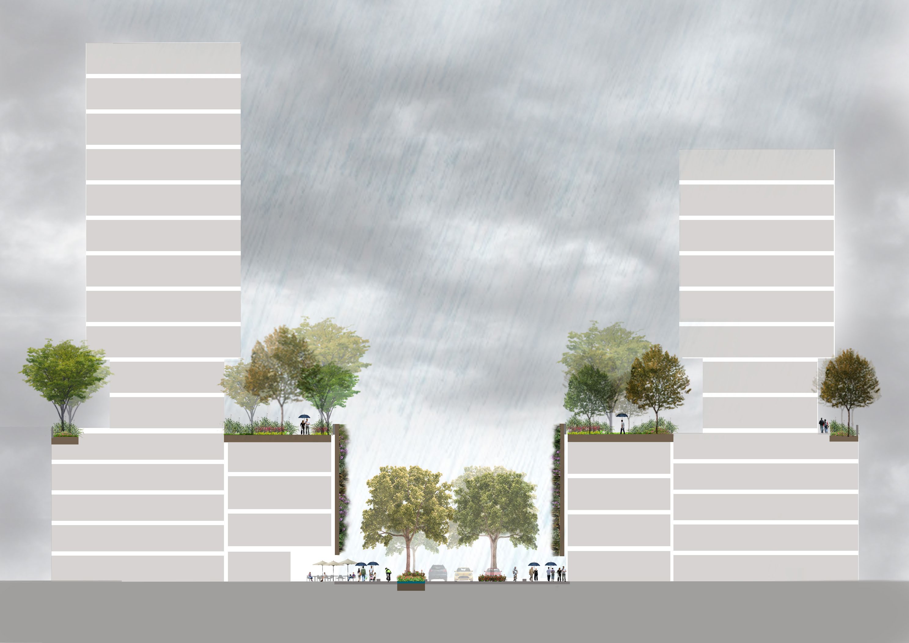
Fishermans Bend, an infill development located at the mouth of Melbourne’s Yarra River, is prone to flooding from the coast, the river, and storms and cloud bursts over the site. The agencies involved in developing Fishermans Bend generated a range of solutions to manage each source of flooding—flood infrastructure (such as levies and pumps), urban planning rules (for example, minimum floor heights) and water sensitive urban design (for example, a street scale rainwater detention using green infrastructure).
The Ideas for Fishermans Bend workshop built the concept of ‘Venice at Fishermans Bend’. Working together, we connected these various solutions into a hybrid strategy that offered ‘multiple lines of defence’. We considered ways to store water in streets, parks and open spaces, and how flood infrastructure could allow water into and through the landscape in a way that created features and character, but still protected life and property from flooding. We also defined permissable uses and urban designs in buildings that would be most exposed to localised flooding.
“These workshops highlighted the opportunity that arises when water managers consider urban planning as a part of their tool box. At the same time, urban planners are considering how to create amenity and creative urban spaces that respond to water,” said Tony Wong (CEO, CRCWSC). “These workshops started a conversation about how to integrate water planning and urban planning. What we need now are new tools and techniques, and most importantly, case studies and exemplar projects that demonstrate how we can use these tools in particular settings and inspire others.”
What IRP3 will do
This two year project seeks to explore and facilitate collaborative planning approaches that consider how urban form, built form and water system servicing options can deliver water sensitive outcomes for urban development. We’re investigating development in different contexts, at a range of scales, and with multiple actors. Our aim is to create an integrated planning framework, and apply the framework in case studies across multiple regions.
Next steps for IRP3
The project began in July 2018. We’re currently building the project team, beginning detailed project planning, and developing research case studies with our partners. As in our other IRPs, the research case studies will be a critical component of the project, serving to test, evaluate and improve the project’s key outputs.
For more information
Check out the project overview flyer, or contact Chris Chesterfield (Project leader)