
Water Sensitive Cities Scenario Tool
Utilise water sensitive city outcomes in scenario planning
Contact
Project Leader - Tools & Products
What is the WSC Scenario Tool
The Water Sensitive Cities Scenario Tool (WSC Scenario Tool) is a planning-support tool that enables users to assess the evolution of urban infrastructure, water networks and population demographics over time.
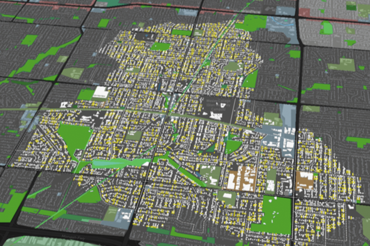
The complex interactions and influence between these elements are modeled in a Geographic Information System (GIS) based platform. Users can input their own data related to the different systems, or harness the available baseline data to simulate different development scenarios. The platform assesses the various development scenarios for changes in water sensitive city outcomes, including effects on the microclimate and urban water cycle. These outcomes are then visualised in a 3D satellite-based map and charts for collaborative learning and additional detailed design - all of which is easily accessible through a web-browser interface (no download necessary; Chrome browser works best).
As a result, users can create personalised adaptation planning strategies and test them under dynamic what-if scenarios with a wide variety of stakeholders.
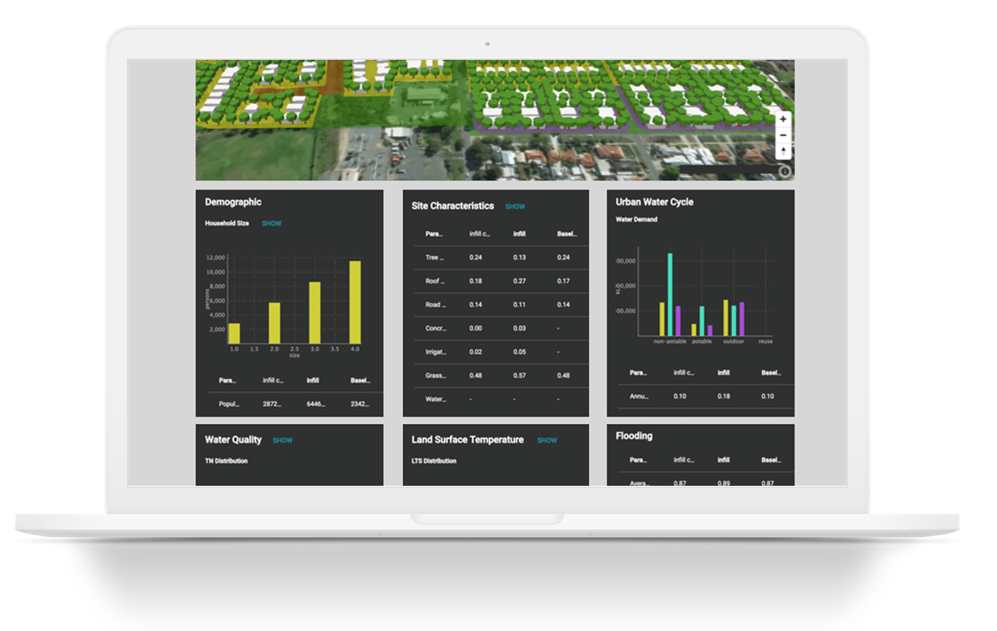

Easy to use interface that showcases the 3D models and the underlying data layers

Dashboard of modelled outcomes from CRCWSC research to inform users and aid in decision making across development scenarios

More modules are under development, with a focus on external integrations with industry standard models
How is the WSC Scenario Tool used?
Project stats
Location
Australia, China
Release date
March 2019
Version
Beta
Contact
New South Wales—Lorena Ikic (lorena.ikic@crcwsc.org.au)
Queensland—Chris Tanner (chris.tanner@crcwsc.org.au)
South Australia—Mellissa Bradley (mellissa.bradley@crcwsc.org.au)
Victoria—Georgie Wettenhall (georgie.wettenhall@crcwsc.org.au)
Western Australia—Emma Yuen (emma.yuen@crcwsc.org.au)
Other states and territories—Research Adoption Team (brisbane@crcwsc.org.au)
If you are interested in applying the WSC Scenario Tool in an international context, please contact the engagement manager for your region:
China – Jianbin Wang (wang.jianbin@crcwsc.org.au)
Indo-Pacific – Kerrie Burge (kerrie.burge@crcwsc.org.au)
All other areas – Malcolm Eadie (malcolm.eadie@crcwsc.org.au)
How are the results generated?
Urban Development Module
- Building on the open-source modelling platform DynaMind, WSC Scenario Tool can simulate socio-economic dynamics, urban development, infrastructure adaptation. These models can be combined to simulate cities as complex and dynamic systems (and scale from street to urban catchment size). This module is synthesised as part of Tranche 1: Projects A4.3, C1.1.
Urban Water Cycle Module (under-development)
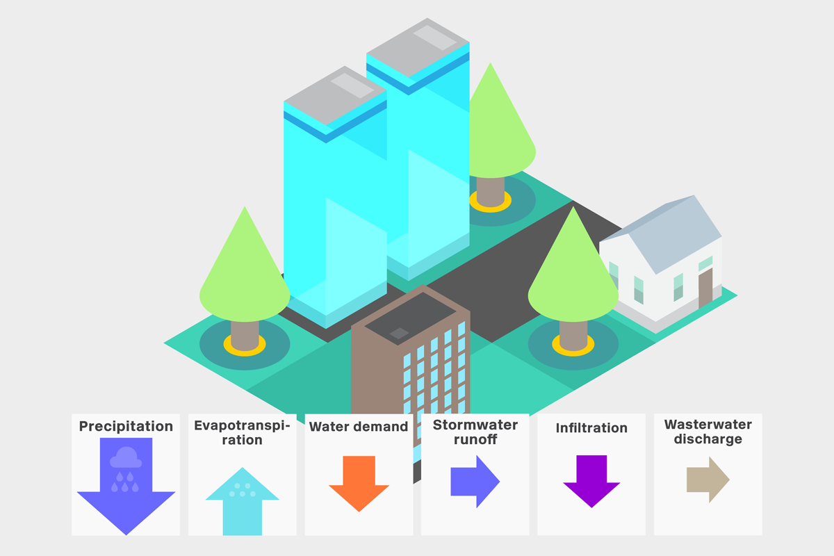
- Displays the water mass balance based on the simulated urban form in the case study region. The insights include changes to water demand, runoff, and overall water security based on user's input and parameter changes to the case study. This module is built on Tranche 1: Projects A4.3, C1.1, and is updated using Integrated Research Project 4 research outputs, thereby enabling users to access the latest CRCWSC research. The module is under development based on testers feedback, and will be available in upcoming releases.
Urban Heat Island Module
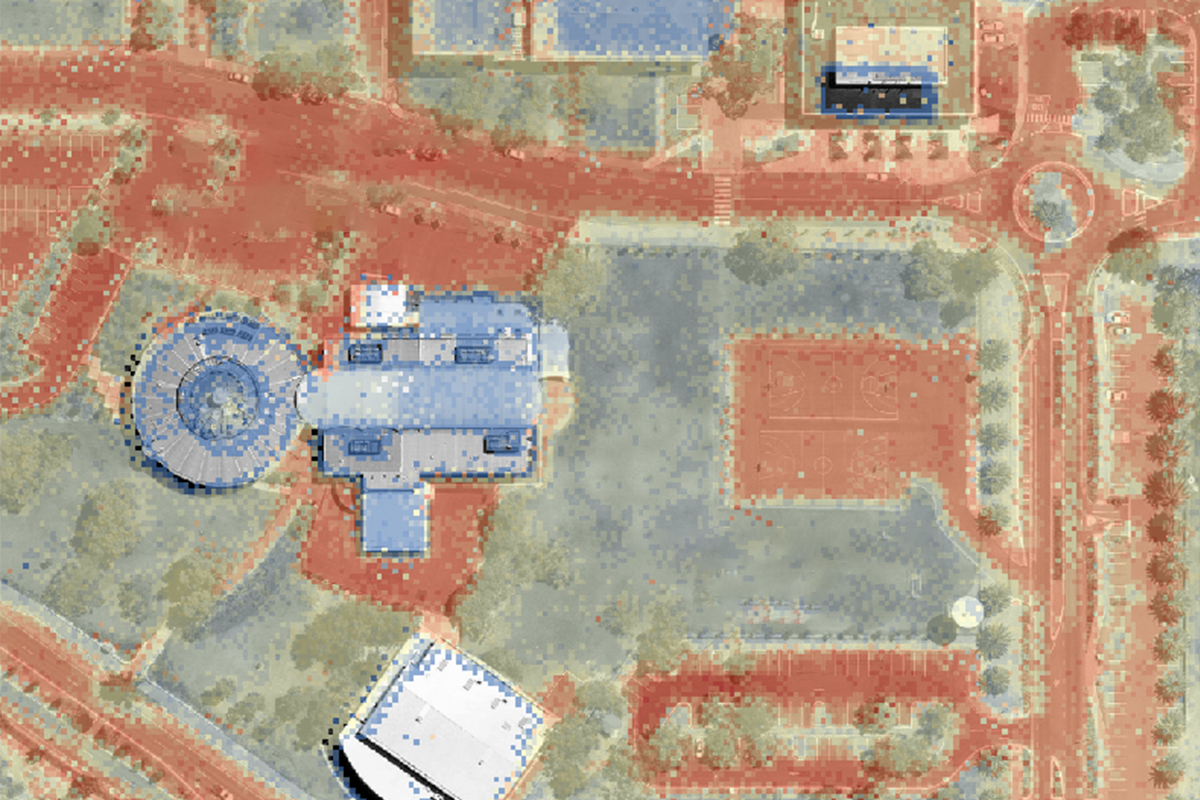
- Displays the spatial variation of different land surface temperatures for a given case study region. The module works by applying temperature data from surface temperature sensors reflective of existing or representative land cover to provide insights into the urban heat island effect. This module reflects work previously done in Tranche 1: Project B3.1, B3.2.
External Integrations (under-development)
- The WSC Scenario Tool is built to enable integration of external industry-standard models. For example, flow and water quality data generated by the Model for Urban Stormwater Improvement Conceptualisation (MUSIC) or Urban Nutrient Decision Outcomes (UNDO) can be used to enhance many of the scenario assessment modules. This feature is currently under development and we look forward to bringing this feature to users.
Disclaimer: Results of the Scenario Tool should only be used for high-level assessments. The quantified indicators represent differences across scenarios and are not to be used as targets for monitoring & evaluation program.
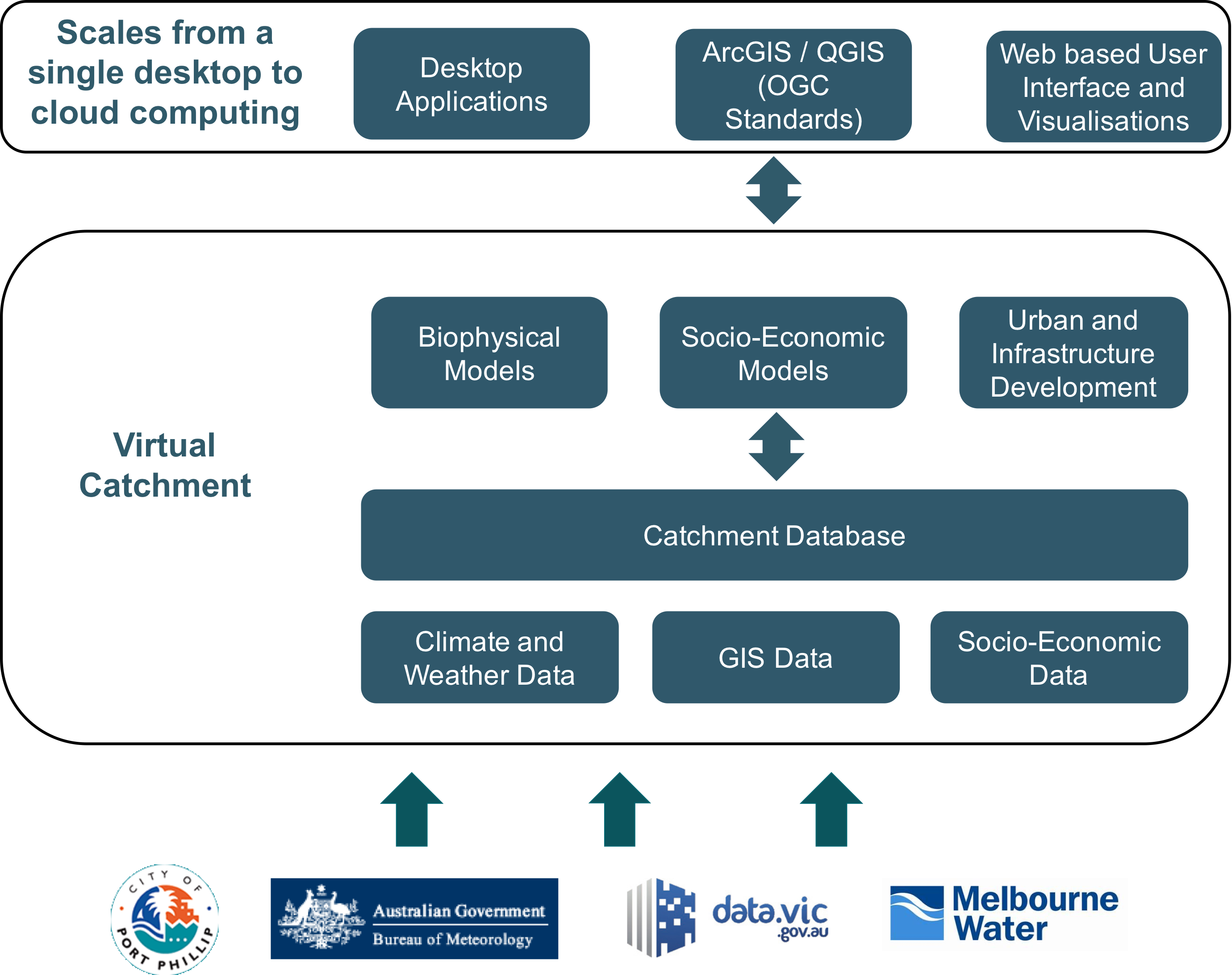
What data are used? (example data architecture)

Comments